Certified Civil Surveyor Course in Lahore | 100% Practical
In the booming construction industry of 2026, the demand for precision and accuracy is higher than ever. Before a single brick is laid or a road is paved, the land must be mapped and measured by a professional. If you are looking for a career that combines technical skills with outdoor field work, the Civil Surveyor course in Lahore at United College of Technology is your gateway to a high-paying future.
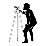
A Civil Surveyor is the “eyes” of a construction project. At United College, we don’t just teach you the theory of measurement; we give you the modern instruments used in the global industry and show you how to master them through 100% practical training.
Why Choose United College for Civil Surveyor Training?
Lahore is expanding rapidly, and new housing societies and infrastructure projects are popping up every day. This creates a massive gap for certified surveyors. At United College, we bridge this gap by offering a curriculum that focuses on real-world expertise.
Hands-on with Modern Tools: We don’t believe in outdated methods. Our lab is equipped with the latest Total Station and Auto Level machines.
100% Practical Field Work: Surveying cannot be learned in a chair. Our students spend their time in the field, setting up instruments and taking real measurements.
Affordable Investment: You can gain this highly technical skill for a total fee of only 45,000 PKR.
Global Certification: While the intensive practical training lasts 3 months, we provide you with a one-year professional diploma, which is essential for jobs in Pakistan and the Middle East.
A Comprehensive Curriculum: Master the Art of Measurement
Our Civil Surveyor course in Lahore is designed to build your future as a land measurement expert. We cover every aspect of modern surveying technology to ensure you are “site-ready” from day one.
1. Mastering the Auto Level
The Auto Level is the foundation of site leveling. At unitedcollegelahore.pk, you will learn:
Instrument Setup: How to perfectly level the machine on a tripod.
Staff Reading: Accuracy in taking elevation readings.
Contouring and Leveling: Creating level surfaces for buildings, roads, and drainage systems.
2. Advanced Total Station Training
The Total Station is the most important tool for a modern surveyor. Most local institutes only show you photos, but we have these machines in our lab for you to use every day. You will master:
Data Collection: Digital mapping of land points.
Stake-out/Setting Out: Marking the exact locations of columns and walls according to a digital plan.
Distance and Angle Measurement: Using laser technology to get millimeter-perfect accuracy.
3. Land Mapping and Calculation
Beyond the machines, we teach you the “brain work” of a surveyor:
Area Calculation: Using coordinate geometry to find the exact area of irregular plots.
Topographic Survey: Understanding the natural and man-made features of a piece of land.
Map Reading: Translating complex engineering drawings into real-world marks on the ground.
Career Opportunities: From Lahore to the Gulf
A certified Civil Surveyor is a VIP on a construction site. Without your signature, the project cannot move forward. By completing the course at United College, you open doors to several lucrative career paths:
| Job Role | Industry Sector | Demand Level |
| Land Surveyor | Housing Societies & Real Estate | Very High |
| Quantity Surveyor Assistant | Cost Estimation Firms | High |
| Site Supervisor | Construction & Engineering | Medium |
| Road Surveyor | Government & Private Infrastructure | High |
In Gulf countries like Saudi Arabia and the UAE, the demand for surveyors who can operate a Total Station is immense. Our one-year diploma is the perfect credential to help you secure a visa and a high-salary package in the international market.
The United College Advantage: Real Practical Experience
What makes us the best Civil Surveyor course in Lahore? It is our commitment to quality. We understand that precision is the difference between a successful project and a disaster.
Our instructors are not just teachers; they are field experts who have worked on major engineering projects. They teach you how to work in different weather conditions, how to coordinate with site engineers, and how to handle expensive surveying equipment with care.
Build Your Future at United College of Technology
If you want a career where you are respected and well-paid, surveying is the answer. Join the most practical-heavy Civil Surveyor course in Lahore and start your journey toward becoming a professional engineer.
Course Duration: 3 Months (Intensive Practical)
Certification: 1-Year Professional Diploma
Total Fee: 45,000 PKR
Official Website: unitedcollegelahore.pk
Our Claim: We provide more practical hours on the Total Station than any other institute in Lahore. With modern tools and a 1-year recognized diploma, your success is guaranteed. “Visit our Lahore campus today for a free demo of our Total Station or apply online at unitedcollegelahore.pk!”